Drone Survey
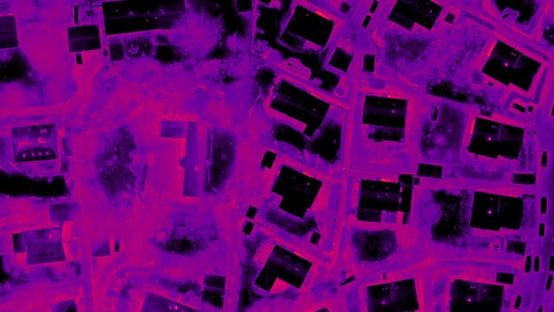
Thermal mapping of the Lerwick District Heating Network.
Lerwick’s district heating network scheduled for inspection.
Shetland Heat Energy and Power are embracing new modern technology to carry out a full thermographic drone survey of the pipe network in the town.
This will be taking place sometime in January weather permitting and the company wants to assure the public that this is a non-intrusive, non-photographic survey which will add value to the long term asset management of the scheme. The survey will take place during the night and hopefully should require no more than two nights of flying.
Sheap Director Derek Leask said :
“Thermal drone surveys are a clear improvement on the available tools when it comes to our asset management effort going forward. These have been used effectively in Scandinavia for a number of years now, and the board and management at Shetland Heat Energy and Power Ltd (SHEAP) have decided that this approach can help improve the resilience and longevity of the district heating pipe network in Lerwick.”
Drone Systems are one of the most experienced and knowledgeable, thermal imaging drone companies in Denmark, almost all their work is on Danish district heating networks. They have carried out work in large cities such as Copenhagen and many smaller towns in Denmark of a similar size to Lerwick. Local drone operators and aerial mapping specialists Shetland Flyer Aerial Media will conduct an aerial survey of the network in January subject to suitable weather conditions, and deliver the thermal data to Drone Systems for analysis.
Environmental conditions must be ideal to guarantee good results. The optimum situation is no rain or wet surfaces, low windspeeds and low relative humidity. Because of this it can be difficult to plan exactly what nights the survey will be done, but SHEaP will continuously advise about planned and completed flights on their website at www.sheap-ltd.co.uk and on the company facebook page ; www.facebook.com/Shetheatenergyandpower
FACTS ABOUT THE DRONE
The drone flies at an altitude of 90 meters above ground, the low noise propellers ensure it is very quiet but with high intensity anti-collision beacons you will see it more than you will hear it. It is equipped with numerous safety systems including dual batteries and multiple sensors that feed real time information back to the pilot. The whole operation has been fully risk assessed to ensure all hazards and safety risks have been mitigated. A crew of two operate the drone, the Remote Pilot who has full control of the aircraft and systems, and an observer who will monitor the drone’s flight path at all times in the air.
The thermal sensor on the drone does not take ordinary pictures, it measures electromagnetic radiation in the wavelengths at 7.5 - 14 µm. During processing the radiation intensity is converted to an actual temperature, the temperature values are assigned a colour and from this the human visible thermal image is created.
Flight operations will be conducted by Shetland Flyer Aerial Media, processing and analysis is performed by Drone Systems for Shetland Heat Energy & Power.
Read more about Drone Systems here: https://dronesystems.dk/en/
Read more about Shetland Flyer Aerial Media here: http://www.shetland-flyer.media/